
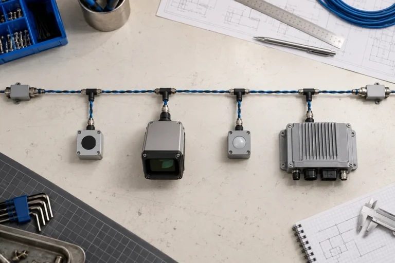
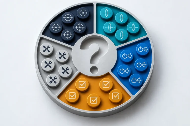
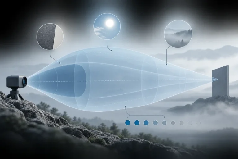

قد يستخدم مستشعران فيزياء قياس مدى متشابهة ومع ذلك يحلان مشكلات مختلفة. اختر بناءً على المعلومات المطلوبة، وليس الملصق الموجود على الغلاف.
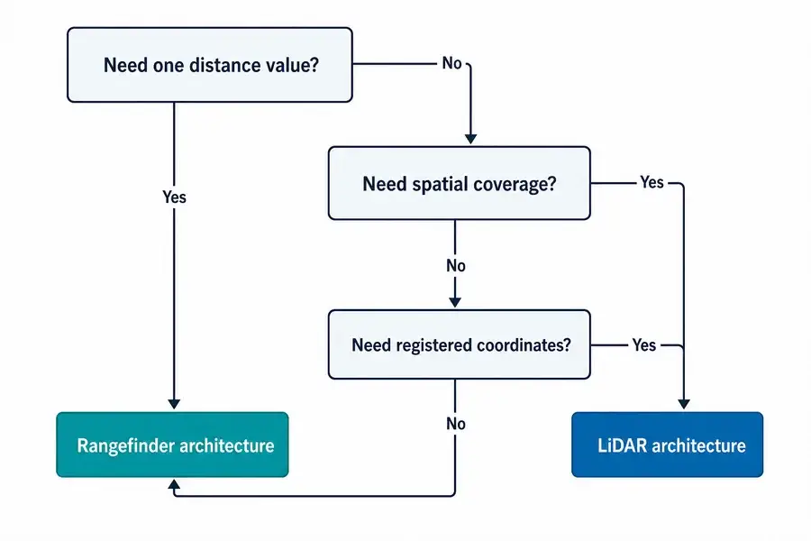
الجانب العملي جهاز قياس المدى بالليزر مقابل الليدار (LiDAR) يبدأ القرار بالخرج المطلوب، وليس بالباعث.
يعيد جهاز قياس المدى بالليزر عادةً المسافة على طول خط رؤية محدد. يجمع الليدار (LiDAR) عينات مدى عبر مجال ويربطها بالاتجاه أو الموقع، منتجًا ملفًا جانبيًا أو صورة عمق أو سحابة نقاط. يمكن أن يكون جهاز قياس المدى نظامًا فرعيًا داخل الليدار، لكن توجيه الشعاع والتسجيل المكاني والمعايرة والمعالجة تجعل الليدار بنية استشعار أكبر.
جهاز قياس المدى بالليزر مقابل الليدار: الفرق هو الخرج
يجيب جهاز قياس المدى بالليزر عن سؤال محدد: ما مدى بُعد الهدف المحدد على طول محور الرؤية هذا؟ قد يكون الخرج قياسًا واحدًا لكل أمر أو تدفقًا مستمرًا. يقرر المضيف ما يجب فعله بتلك المسافة.
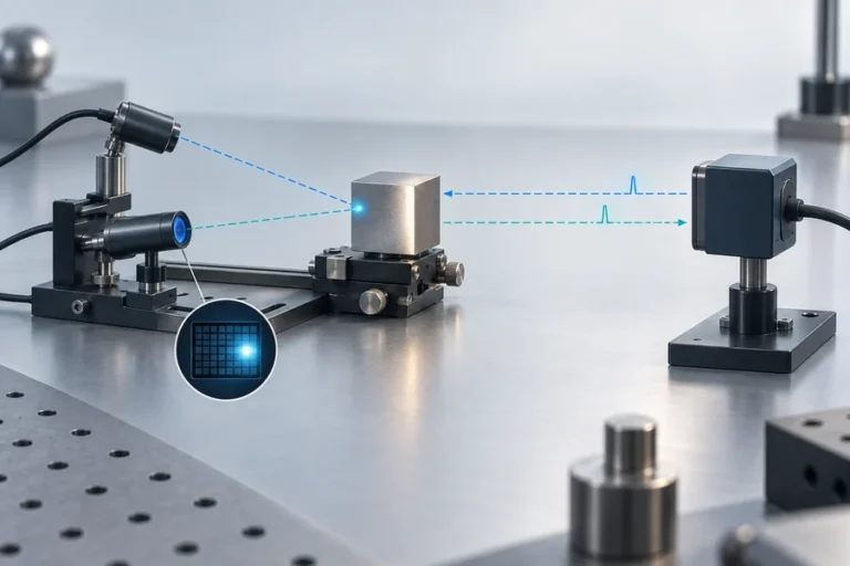
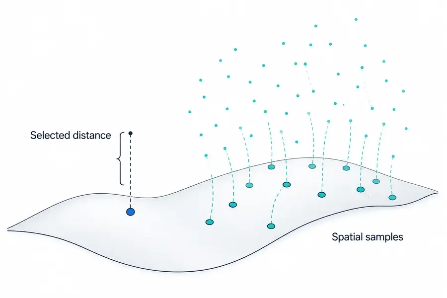
يجيب الليدار عن سؤال مكاني. يربط القياسات باتجاه أو بكسل أو موقع المنصة. قد يكون الخرج ملفًا جانبيًا ثنائي الأبعاد أو إطار عمق أو سحابة نقاط XYZ.
هذا يجعل “نقطة واحدة مقابل نقاط متعددة” تقريبًا أوليًا مفيدًا، وليس تعريفًا عالميًا. توجّه بعض أنظمة الليدار شعاعًا ميكانيكيًا. يستخدم البعض الآخر توجيهًا بالحالة الصلبة أو مصفوفات كاشف أو إضاءة وميضية أو أخذ عينات هجينًا. التمييز الدائم هو ما إذا كانت الأداة تسلّم تدفق مدى محددًا أو بيانات مدى منظمة مكانيًا.
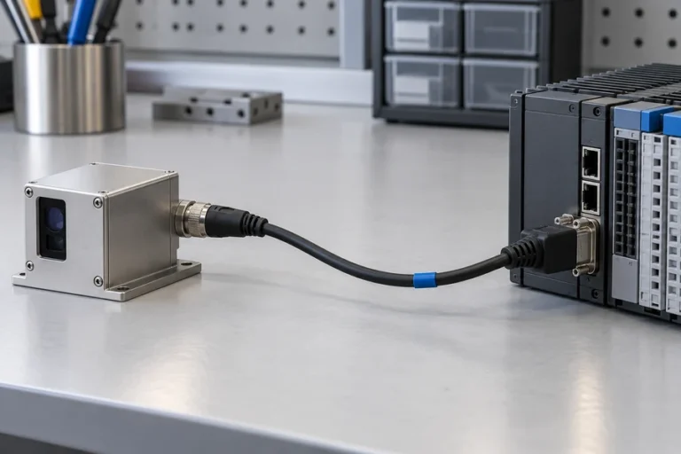
للتعريف على مستوى الوحدة، انظر ما تحتويه وحدة جهاز قياس المدى بالليزر.
يتشاركون في فيزياء قياس المدى لكن ليس في نفس حدود النظام
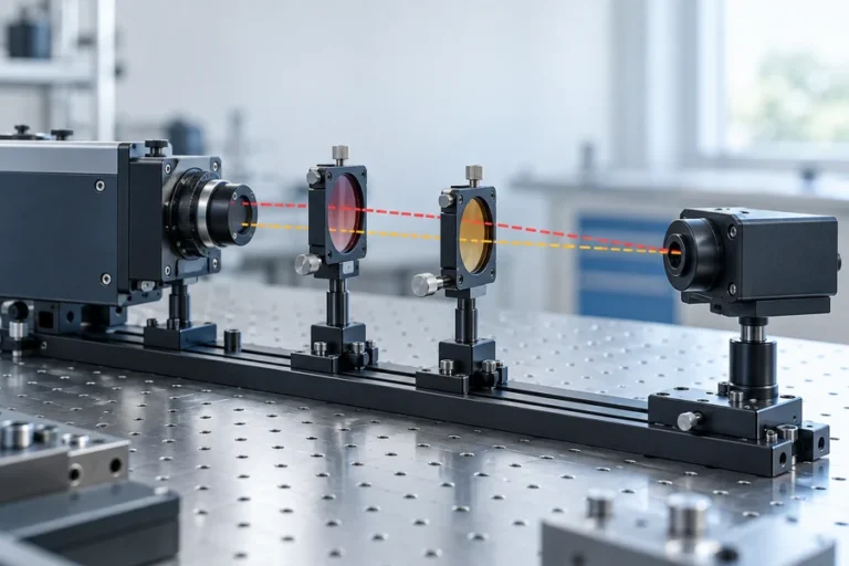
قد تنقل كلتا الفئتين الضوء وتجمعان الإرجاع وتقدّران المسافة من زمن الرحلة ذهابًا وإيابًا. تستخدم بعض الأنظمة طرقًا قائمة على الطور بدلاً من ذلك. لا تحدد طريقة قياس المدى بحد ذاتها ما إذا كانت الأداة المكتملة تُسمى جهاز قياس مدى أو ليدار.
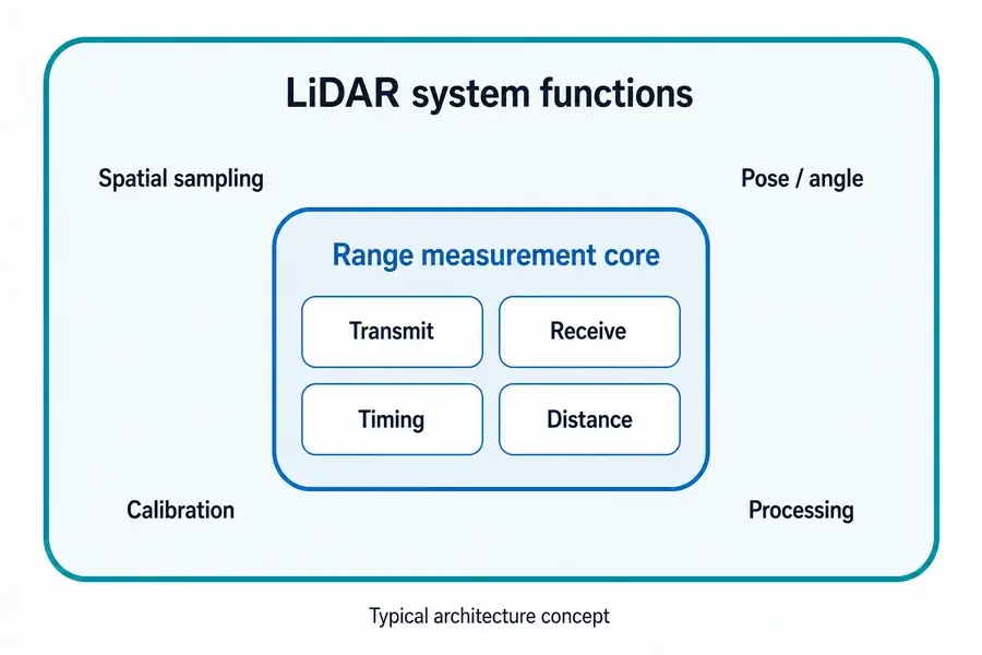
تجمع وحدة قياس المدى النموذجية بين مصدر وبصريات وكاشف وإلكترونيات تمهيدية تناظرية وإلكترونيات توقيت أو طور ومعالجة إشارات وواجهة مضيف. تعيد المسافة دون إنتاج نموذج مشهد. دليلنا حول كيفية عمل قياس المدى بالليزر يتبع هذه السلسلة.
يضيف نظام الليدار الوظائف اللازمة لوضع عينات مدى متعددة في الفضاء. اعتمادًا على البنية، قد تشمل تلك الوظائف توجيه الشعاع أو مستقبل تصوير، وقياس زاوية المسح، ومزامنة الساعة، ومدخلات الموقع والاتجاه، والمعايرة الهندسية، ومعالجة سحابة النقاط. يصف دليل الليدار التابع للإدارة الوطنية للمحيطات والغلاف الجوي (NOAA)، على سبيل المثال، الجمع بين زمن الرحلة وزاوية المسح والتحديد الجغرافي المباشر لحساب الإحداثيات ثلاثية الأبعاد.
لهذا السبب يمكن أن يكون جهاز قياس المدى نظامًا فرعيًا داخل أداة ليدار مسح ضوئي. يوفر قياس المدى؛ ويحدد باقي النظام مكان انتماء تلك العينة.
عندما يكون المصدر نفسه قيد التقييم، فإن منصة ليزر الألياف النبضية Lumexis لليدار تغطي طبقة نظام مختلفة عن الماسح الضوئي الكامل.
قارن المتطلبات التي تغيّر التصميم فعليًا
تصبح البنية الصحيحة أكثر وضوحًا عندما تُكتب مواصفات الخرج قبل مواصفات المستشعر.
| المتطلب | جهاز قياس المدى بالليزر | نظام الليدار | النتيجة التكاملية |
|---|---|---|---|
| الخرج الأساسي | المسافة إلى هدف أو محور محدد | ملف جانبي مكاني أو إطار عمق أو سحابة نقاط | يحتاج الليدار إلى نموذج إحداثيات وبيانات |
| التغطية | ضيقة أو موجهة أو يعيد المضيف تموضعها ميكانيكيًا | اتجاهات مشهد متعددة أو بكسلات لكل دورة اكتساب | يصبح نمط المسح أو هندسة المصفوفة متطلبًا |
| حمل بيانات المضيف | رسائل مسافة صغيرة نسبيًا | مجموعات بيانات مكانية أكبر | يجب تخصيص ميزانية للمعالجة والتخزين والنقل |
| معرفة الحركة | مطلوبة عندما يجب على المضيف تفسير خط رؤية متحرك | غالبًا ما تكون ضرورية لتسجيل العينات من منصة متحركة | تؤثر مزامنة التوقيت والوضع على جودة الخريطة |
| المعايرة | محاذاة البصر، وإزاحة المدى، والتحقق من الهدف والبيئة | معايرة المدى بالإضافة إلى الزاوية والمكانية والتوقيت وغالبًا متعددة المستشعرات | يجب تحديد ملكية المعايرة مبكرًا |
| الأنسب | هدف معروف أو محور تحكم | اكتشاف المشهد، رسم الخرائط، إعادة بناء السطح | الاختيار بناءً على القرار الذي يجب أن يتخذه المضيف |
التغطية ليست مجرد مجال رؤية. اسأل كيف يتم أخذ عينات من المجال، وكم مرة يتم إعادة زيارة كل موقع، وكيف يتم الإبلاغ عن المناطق منخفضة الثقة.
إطار الإحداثيات مهم بمجرد أن يتحرك المستشعر. يمكن أن تكون قيمة المدى صالحة بينما يكون موضع XYZ المعين لها خاطئًا بسبب خطأ الزاوية، أو إزاحة الوقت، أو خطأ الوضع، أو الانحناء الميكانيكي. بالنسبة للتحكم في المحور الثابت، قد لا توجد مصادر الخطأ الإضافية هذه أو قد يتم التعامل معها بواسطة الهندسة الحالية للآلة.
معدل البيانات وزمن الاستجابة يغيران أيضًا التكامل. يمكن أن يتطلب الاستشعار المكاني فك تشفير الحزم، والطوابع الزمنية، والتصفية، والتسجيل، ومعالجة الثقة، وقدرة حاسوبية كافية للوفاء بالموعد النهائي لحلقة التحكم.
انظر الفرق في نطاق التطبيق بين حل قياس مدى الليزر المستهدف المحدد و حل LiDAR ورسم الخرائط ثلاثية الأبعاد.
الدقة والمدى والطاقة والتكلفة ليس لها فائز عالمي
تعلن العديد من المقارنات أن فئة واحدة أكثر دقة، أو أطول مدى، أو أصغر، أو أرخص، أو أقل استهلاكًا للطاقة. هذه العبارات غير قابلة للدفاع عنها دون شروط مشتركة.
دقة مسافة جهاز قياس المدى ليست قابلة للمقارنة مباشرة مع دقة XYZ المطلقة لخريطة LiDAR. تتضمن الخريطة خطأ القياس بالإضافة إلى معايرة الزاوية، والتوقيت، ووضع المنصة، والتسجيل، وأحيانًا تعويض الحركة. على العكس، قد يكرر جهاز LiDAR القياسات عبر اتجاهات عديدة بينما يركز جهاز قياس المدى ميزانيته البصرية والمعالجة على مسار واحد محدد.
يعتمد المدى أيضًا على انعكاسية الهدف، والفتحة، والتباعد، وحساسية المستقبل، والغلاف الجوي، والضوء المحيط، والمحاذاة، ومعالجة الإشارات، ومعدل القياس، ومعيار القبول. يجب مقارنة الطاقة والتكلفة عند نفس حدود النظام: الوحدة المجردة والمستشعر المكاني الكامل ليسا قائمتي مواد متكافئتين.
بالنسبة لتنوعات بنية جهاز قياس المدى ومقايضاتها، استخدم دليل أنواع وحدات قياس مدى الليزر كنقطة انطلاق.
اختر جهاز قياس المدى عندما يحل تدفق مسافة واحد مشكلة التحكم
عادةً ما يكون جهاز قياس المدى فعالًا عندما يكون الهدف أو المحور معروفًا. تشمل الأمثلة الخلوص، والارتفاع فوق سطح، والتحكم في المسافة الثابتة، وتحديد المواقع بناءً على ميزة محددة، ومسافة الفحص.
اكتب المتطلب من حيث الهدف، وليس فقط المسافة القصوى. حدد حجم الهدف ونطاق الانعكاسية، وعدم اليقين الزاوي، ومعدل التحديث، ومعدل القراءات غير الصالحة المسموح، وبيئة التشغيل، والغلاف الميكانيكي، والواجهة الكهربائية، وكيف سيتم التحقق من صحة التثبيت النهائي.
هذا يحافظ على وضوح نطاق المستشعر وواجهة المضيف مع تجنب البيانات المكانية التي قد يتجاهلها المتحكم.
اختر LiDAR عندما تكون التغطية المكانية هي المخرجات المطلوبة
يكون LiDAR مناسبًا عندما يجب على النظام اكتشاف الأسطح أو الأجسام عبر مجال بدلاً من قياس خط رؤية واحد معروف. يعتمد رسم الخرائط المدنية، والاستشعار عن بعد، وفحص البنية التحتية، ورسم ملامح التضاريس، وإعادة البناء ثلاثي الأبعاد جميعها على التغطية المكانية.
يجب على الفريق تحديد هندسة أخذ العينات، وكثافة النقاط المفيدة، وسلوك إعادة الزيارة، والطوابع الزمنية، وأطر الإحداثيات، والحركة، والمعايرة، وحقول الثقة، وتنسيق الإخراج، والبرمجيات النهائية. سحابة النقاط الكثيفة ليست مفيدة حتى يتم التحكم في هذه العناصر.
يتبع اختيار الماسح الضوئي المشهد. الأنظمة الثابتة، والمتحركة، والمسح الخطي، والقائمة على المصفوفات، والمحمولة جوًا لا تتحمل نفس عبء المعايرة. تعامل مع “LiDAR” كبداية لنقاش البنية، وليس نهايته.
حدد الواجهة قبل أن تطلب مستشعرًا
قبل طلب توصية، أرسل موجز نظام قصير:
- المخرجات المطلوبة: مسافة واحدة، ملف جانبي، إطار عمق، أو سحابة نقاط.
- الهدف والمشهد: الحجم، نطاق الانعكاسية، الحواف، الخلفيات، والعوائق المحتملة.
- الهندسة: نطاق المسافة، مجال الرؤية، عدم اليقين في التوجيه، وحركة المنصة.
- التوقيت: معدل التحديث، زمن الاستجابة، المزامنة، ومتطلبات الطابع الزمني.
- البيئة: درجة الحرارة، الضوء المحيط، الغلاف الجوي، الاهتزاز، وقيود الغلاف.
- الواجهات: الطاقة، الاتصالات، التشغيل، تنسيق البيانات، والتشخيصات.
- الغلاف الميكانيكي: الحجم، الكتلة، التركيب، النافذة، المسار الحراري، وإمكانية الوصول للمحاذاة.
- التحقق من الصحة: الأهداف، ظروف التشغيل، مقاييس النجاح/الفشل، وحجم العينة.
يمكن لمهندسي تطبيقات LUMEXIS مراجعة هذه المدخلات عبر اختيار المنتج، والتكامل، والتحقق من الصحة، واستكشاف الأخطاء وإصلاحها. يقوم فريقنا بتصميم وتصنيع وحدات قياس مدى الليزر ومصادر ليزر LiDAR، مع قدرات بصرية، وبصريات ميكانيكية، وإلكترونيات، وبرامج ثابتة، وحرارية، وقدرات قياس الإشارات الضعيفة. يمكن لدعم الهندسة والتخصيص متاح للبرامج القياسية والمخصصة والمناسبة للعلامات الخاصة؛ يمكن شحن المنتجات القياسية خلال ثلاثة أيام، بينما يعتمد التوقيت المخصص على المشروع.
الأسئلة الشائعة
هل جهاز قياس مدى الليزر هو نفسه LiDAR؟
ليس عادةً على مستوى المنتج. يعيد جهاز قياس المدى عادةً المسافة على طول خط رؤية محدد. ينظم LiDAR القياسات عبر اتجاهات أو بكسلات متعددة في بيانات مكانية. قد يكون محرك القياس الأساسي مشابهًا، وبعض الموردين يستخدمون المصطلحات بشكل فضفاض، لذا قم بتقييم المخرجات وحدود النظام بدلاً من الاسم وحده.
هل يمكن استخدام وحدة قياس مدى الليزر داخل نظام LiDAR؟
نعم. في بعض البنيات الماسحة، يوفر جهاز قياس المدى قياس المسافة بينما التوجيه، وقياس الزاوية، والتوقيت، والموضع/الاتجاه، والمعايرة، والمعالجة تضع كل عينة في ملف جانبي أو سحابة نقاط. لا يزال التوافق يعتمد على معدل التحديث، والتشغيل، والواجهات، والهندسة البصرية، والمزامنة.
هل يمكن لجهاز قياس المدى إنشاء سحابة نقاط؟
ليس بمفرده. يمكن للمضيف تحريك أو توجيه جهاز قياس المدى ودمج كل مسافة مع الزاوية والوضع المعروفين، لكن النظام الناتج يضيف أخذ عينات مكانية ومعايرة ومعالجة. عند تلك الحدود، تؤدي الأداة الكاملة وظيفة مسح شبيهة بـ LiDAR حتى لو كانت الوحدة الأصلية تعيد نطاقات.
هل يكون LiDAR دائمًا أكثر دقة من جهاز قياس مدى الليزر؟
لا. حدد الدقة التي تتم مقارنتها. قد يحدد جهاز قياس المدى خطأ المسافة على طول محور واحد، بينما قد يتطلب ناتج الليدار دقة المدى والزاوية والوضعية والتوقيت والتسجيل. قارن كلا النظامين على نفس الهدف والمسافة والبيئة وحالة الحركة ومعدل التحديث والمقياس النهائي للناتج.
هل يستخدم كل ليدار ماسحًا متحركًا؟
لا. المسح الميكانيكي شائع، ولكن التوجيه بالحالة الصلبة، والتقاط العمق القائم على الفلاش أو المصفوفات، والأساليب الهجينة موجودة أيضًا. المتطلب المشترك هو أخذ العينات المكانية وتنظيم القياسات المتعددة، وليس آلية توجيه إلزامية واحدة.
المراجع
- مركز خدمات السواحل التابع للإدارة الوطنية للمحيطات والغلاف الجوي،, ليدار 101: مقدمة لتقنية الليدار والبيانات والتطبيقات.
- هيئة المسح الجيولوجي الأمريكية،, تقنية الكشف عن الضوء والمدى الأرضية.
- هيئة المسح الجيولوجي الأمريكية،, يلعب إيروس دورًا رئيسيًا في تطور تقنية الليدار وتطبيقاتها.
- ليكا جيوسيستمز،, تطور الليدار.
إذا شاركت نوع الإخراج، والهدف، ونطاق المدى، ومجال الرؤية، والحركة، والواجهة، والبيئة، والغلاف،, اتصل بفريق هندسة لوميكسيس. يمكننا المساعدة في تحديد ما إذا كانت وحدة قياس المدى القياسية، أو مصدر ليزر الليدار، أو تكوين مخصص يناسب حدود النظام التي حددتها.